Feature Highlights

Spatial Pairing Analysis

February 6, 2025
News > Spatial Pairing Analysis

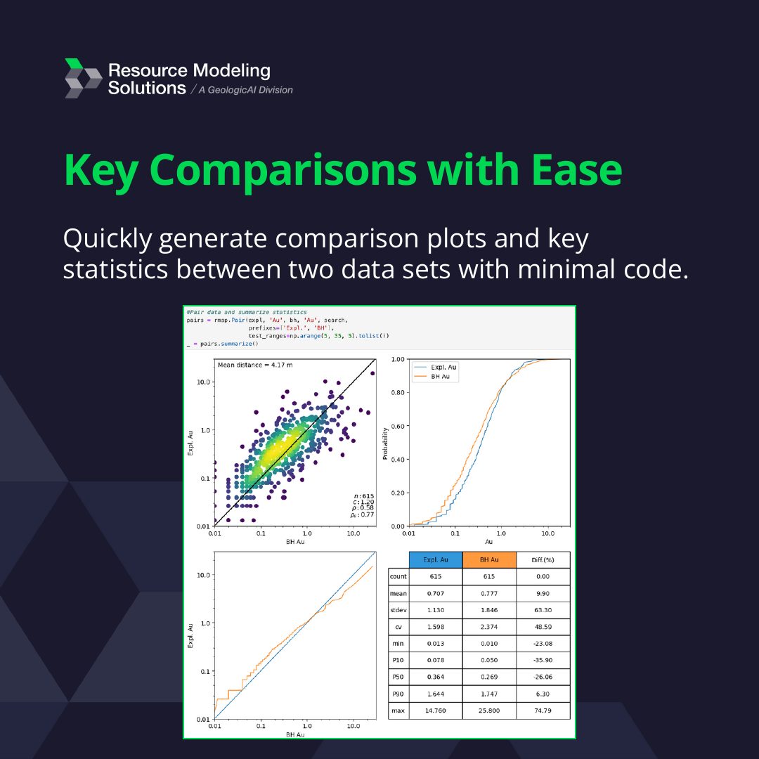
Spatial pairing analysis compares two data sets, such as different drilling types or sampling campaigns, with minimal code:

  • Generate comparison plots and key statistics between the data sets
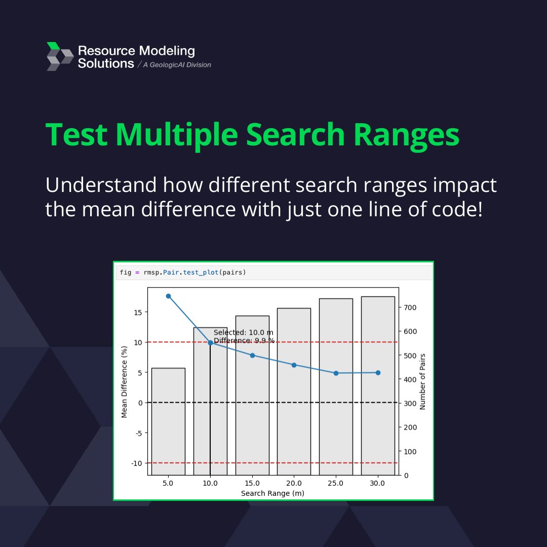
  • Test how different search ranges affect the mean difference with one line of code
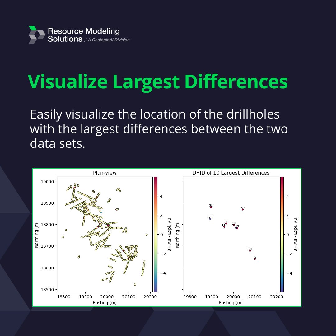
  • Visualize the drill holes with the largest differences
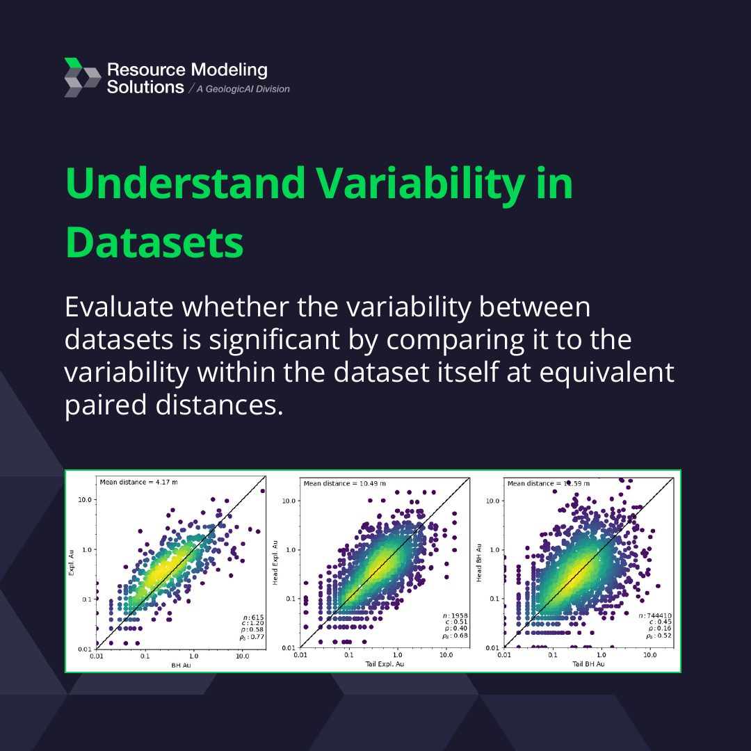
  • Judge whether the variability between data sets is significant by comparing it with the variability within each data set at equivalent paired distances

Contact us at contact@resmodsol.com to schedule an RMSP demo.

Spatial Pairing Analysis, image 1 of 5
Spatial Pairing Analysis, image 2 of 5
Spatial Pairing Analysis, image 3 of 5
Spatial Pairing Analysis, image 4 of 5
Spatial Pairing Analysis, image 5 of 5
Divider
Back to all news
Talk To Our Experts
White Squares
contact@resmodsol.com
Offices located in:
Canada:
  • Edmonton, Alberta
  • Calgary, Alberta
  • Toronto, Ontario
United States of America:
  • Denver, Colorado
Australia:
  • Brisbane, Queensland
South Africa:
  • Johannesburg
Chile:
  • Santiago
GeologicaAI Logo
Resource ModelingSolutions
Resource Modeling Solutions, a division of GeologicAI, is focused on helping modern mining and environmental companies manage uncertainty and understand geological variability to make the best decisions possible.
Sign up below for our newsletter
Copyright © 2018-2026 Resource Modeling Solutions Ltd. All rights reserved.
Privacy Policy